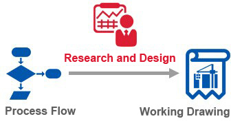
The field examination is the first step for the Engineering design. It involves the Mechanical, Piping, Hydraulic, Civil, Structural, Architecture, Electrical Instrumentation and Control, transportation and Drafting; Meanwhile the owner should supply the documents as below for making sure the engineering design successfully.
1 Civil Works
Topographical features of the site
Hydrological geology data
Geotechnical survey report
Local architectural and consider the local materials and customs for doing waterproof and heat preservation.
Material supply as aggregate, brick, plank, steel and cement etc.
Labor force cost
2 Electric condition
Power supply around the mine, including:
Transformer substation or T" type connection of power supply circuit
Voltage and frequency
Distance of power supply
Topography and landform between the site and power supply
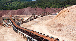
3. Mine site survey:
Test report or and representative sample
Topographic map of the minesite
Environmental protection requirements
Water, electricity, tailings reservoir condition around the site
Investment plan
4 Water supply and drainage
Water supply for production and living:
Water reserves and water quality,
Drainage mode and discharge
Outlet selection of fresh water and production wastewater
Sewage treatment
The height difference and transport distance
Dual pipes are necessary or not.
5 Layout and transportation
a. Geographic and topographic data:
Project Location
Nearby town, Transportation lines and rivers
Topographic map: 1:10000,1:2000 ( for location selection);
1:1000,1:500( for construction)
b. Economic environment:
The distribution of village and the population of residents
Agricultural production and local land utilization conditions
Possibility cooperation with adjacent enterprises
Local construction materials manufacture and supply conditions.
Local water supply and drainage, power supply
c. Meteorology
Microclimate characters on the site
Wind direction, wind rose map, maximum and average wind speed
Maximum,average snowfall and rainfall over the years
Annual air temperature info, max, mini and average
d. Waterfall:
Historical maximum flood level near the site
Maximum,minimum flow, catchments area of the nearby river
Water loss and soil erosion, water and soil protection and planning conditions
e. Engineering geology and hydrologic geology:
Geological disaster situation which means has the possibility to have fault age, landslide, collapse and debris flow
Soil type, soil property and allowable bearing capacity of foundation soil
Earthquake and destruction of the building
PH value, depth and rise and fall of groundwater
f. Traffic condition:
Like existing road and railway conditions and also the transport ability, engineering factors, trafficability of the bridge and tunnel, loading and unloading facilities and transportation cost etc.